ABORIGINAL AUSTRALIA
We acknowledge and pay respect to the Ngarinyin people, who are the traditional custodians of the land upon which El Questro Homestead stands. In sharing elements of their history, heritage and culture we acknowledge Ngarinyin people of the Kimberley and their connections to Wilinggin Country.
We pay our respects to all Aboriginal and Torres Strait Islander Elders past, present and emerging.
LOCATION
Located on the northern-most part of Western Australia and covering some 421,451 square kilometres (approximately 261,000 miles), an area three times the size of England and three fifths the size of Texas (USA).
CLIMATE
The Kimberley dry season is characterised by clear blue skies, easterly winds and balmy days with some chilly nights. The weather is very stable and the chance of rain very unlikely. However, during the wet season, the Kimberley becomes hot and humid, sometimes violent, and above all unpredictable.
Home / Destinations / The Kimberley
The Kimberley
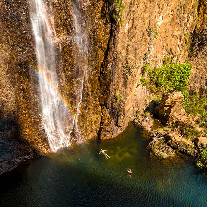
The Kimberley is one of Australia's hidden treasures with an immense and complex landscape that encompasses spectacular gorges, waterfalls and cave systems, pockets of lush rainforest and an astonishing variety of wildlife. Wild and wonderful, the Kimberley is one of the world's last great wilderness areas.
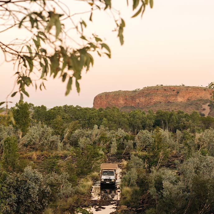
The Kimberley in Western Australia's far north is a dramatic area of waterfalls, gorges, beaches and rugged outback. Despite, or maybe because of, its remoteness, The Kimberley is growing in popularity as a destination. The unfettered space and wild beauty of this region is unparalleled and unforgettable.
The Kimberley is home to only 40,000 people meaning that there are fewer people per kilometre than almost any other place on the planet. Nearly half of the region's population are First Nations people and the region holds deep cultural significance for the approximately 160 Aboriginal communities and 30 different language groups of the area.
Located north of the Tropic of Capricorn, the climate in the Kimberley is a tropical monsoon climate, defined by a distinct wet season and dry season. This climate is typical not only in Western Australia, but across all of Australia's North.
The Kimberley dry season is characterised by clear blue skies, easterly winds and balmy days with some chilly nights. The weather is very stable, and outdoor activities and events can be planned years in advance, as the chance of rain is very unlikely. The wet season however, is a different story as the Kimberley becomes hot and humid, sometimes violent, and above all unpredictable.
It is a vast area of dramatic and relatively undisturbed landscapes that has great biological richness and provides important geological and fossil evidence of Australia's evolutionary history. Dinosaur footprints on the west coast of the Dampier Peninsula are a remarkable remnant of ancient life in the Kimberley. Today, much of the Kimberley is predominately covered in open savanna woodland dominated by bloodwood and boab trees. The red sandy soil of the Dampier Peninsula in the south is known for its characteristic pindan wooded grassland, while in the more fertile areas like the Ord Valley, the trees are found in grasslands in the wetter valleys. The banks of the rivers such as Ord and Fitzroy River a greater variety of vegetation is found, and in estuaries where the coast is flatter, there are also areas of mangroves.
The Kimberley region is home to hundreds of thousands of rock art paintings and drawings known as Bradshaw or Wandjina rock art. These beautiful and mysterious paintings are hidden in outback bush galleries on the huge escarpments and terracotta rock surfaces of the north Kimberley.
The Horizontal Waterfalls, known as Garaanngaddim by the local First Nations people, a natural phenomenon where tidal flows cause huge waterfalls on the ebb and flow of each tide. The Rowley Shoals is famous for world-class snorkelling and Montgomery Reef is a unique ecosystem that must be seen to be believed – 140 square miles of coral reef rises out of the ocean with water cascading from the reef as the tide falls exposing a privileged glimpse of another world.
The first European to explore the region was Alexander Forrest in 1879, he named the Kimberley district, the Margaret and Ord Rivers, the King Leopold Ranges, and the fertile area between the Fitzroy and Ord Rivers. He subsequently set himself up as a land agent specialising in the Kimberley's and was instrumental in the leasing of over 51 million acres in the region during 1883.
The Durack family sought Forrest's advice and went on to establish the Lissadell, Argyle, Rosewood and Ivanhoe cattle stations in the Kimberley's. It was at the Ivanhoe Station, to the north of Kununurra, that Kimberley Durack first began experimenting with the possibility of growing cash crops on the rich black alluvial soils of the Ord River valley. This was to later grow into the Ord River Scheme.
European colonisation expanded during the late 19th century, when cattle were driven across Australia from the eastern states in search of good pasture lands. Many other Europeans arrived soon after, when gold was discovered around Halls Creek and pearls were harvested at Broome. However, long before the arrival of Europeans, Aboriginal people along the west Kimberley coast collected the large, luminous pearl shell for use in rituals and ceremonies. It is the most widely distributed item in Aboriginal Australia, traded across two-thirds of the continent.